
The Tabula Peutingeriana was an ancient map believed to have first been constructed by the ancient Romans, although the copy we have today was drawn in 1265. While reading Charles' Allen Coromandel: A Personal History of South India, I learnt about this map, and that it included South India in it.
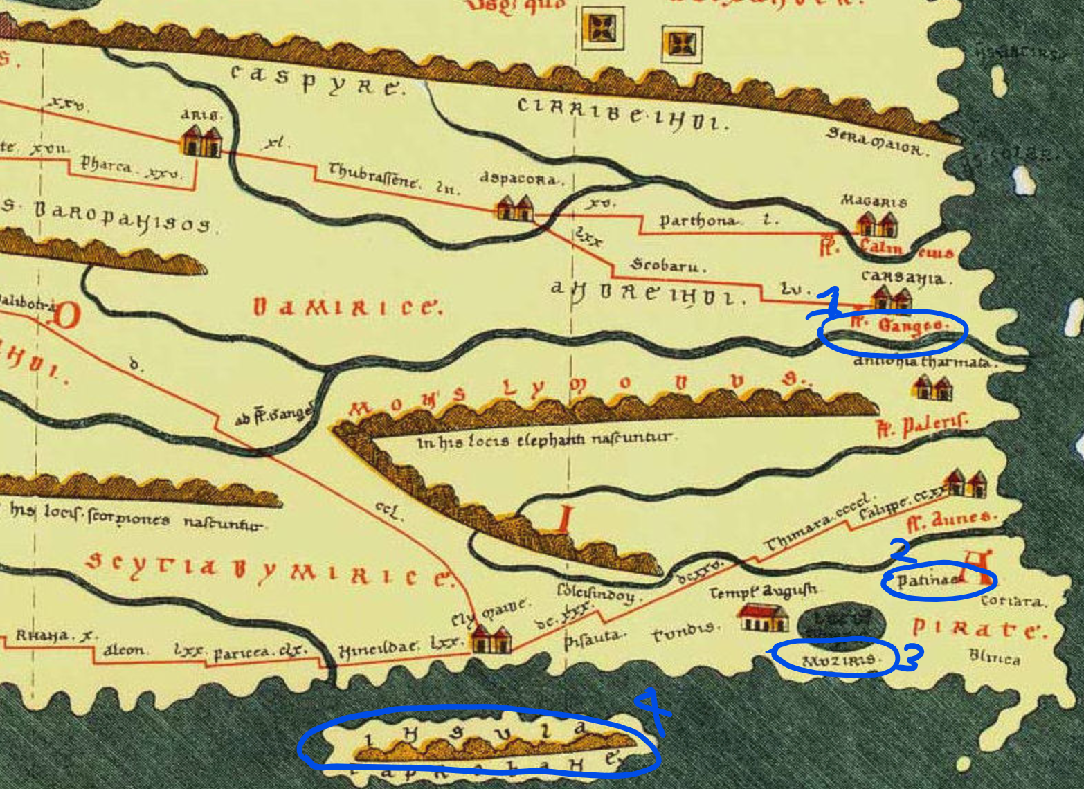
Below is the section of the map covering India. It's very oddly shaped compared to today's maps, so I've marked four points on it to help orient the reader.
The points marked 1-4 are as follows:
- The river Ganges, draining into what is today the Bay of Bengal.
- Patinae: According to Charles Allen, this probably refers to the town now named Nagapattinam in Tamil Nadu, on the south-eastern coast of India.
- Muziris: An ancient harbour in Kerala whose exact location is now unknown, on the south-western coast of India. As a side note, the building to the left of it on the map claims to be a temple to Augustus.
- Insula Taprobane: Believed to be what the Romans called Sri Lanka. It's incorrectly placed to the west of India, near Kerala, while it should have been more towards the east near Tamil Nadu.
To help with orientation, here's the modern map with the same four points marked:

It was really interesting to learn that the Romans and Greeks had such deep ties to South India.
Also personally fascinating to me was their awareness of Patinae (now Nagapattinam, point 2 above), which even today is a small town of around 50,000 people. I lived there for around two years when I was around six years old :)